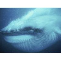
Shattered Myth of the Scattered Blue Whale Has Them at Risk in Shipping “Hot Spots”

Whalers, armed with new-fangled harpoon cannons, killed a record 29,649 blue whales in 1931. There are only an estimated 10,000 left on the planet, but ships have no trouble running into them along shared routes they use off the West Coast.
A new study published in the journal Plos One found that two of the densest food locations for blue whales lie across busy shipping lanes, contradicting earlier studies that said whales were widely dispersed and safer for it. But those studies were largely based on anecdotal sightings and limited data.
The new study tagged 171 blue whales, the world’s largest creatures, and tracked them for 15 years using satellites. Researchers said the data represented the most comprehensive collection for any whale species. It is estimated that around 2,500 of them cavort in waters off California, Oregon and Washington. They mostly eat krill (euphausiids).
“While the whales in this study generally occupied a wide region, most of the areas of highest concentration were close to large human population centers and busy port terminals,” the report said.
The diciest time is between July and October, when shipping is as its peak. Merchant lanes near the Channel Islands off Santa Barbara pose the largest threat to whales, but areas near the Gulf of Farallones by San Francisco, and Cape Mendocino also overlap with whale routes and feeding.
The report recommends shifting the Santa Barbara shipping lanes southward and shutting the northern routes near San Francisco between August and November. Perhaps sensing that second suggestion wasn’t going to fly, the report offers an alternative of creating one east-west lane along a different path that would cross the high-density whale areas quickly.
Any changes in shipping routes would be complicated by the U.S. Navy’s extensive Pacific testing and training. Michelle Berman-Kowalewski, a marine mammal biologist not associated with the project, told National Geographic that the Santa Barbara alternative route would be a problem for the military.
The International Whaling Commission enacted protections for blue whales in 1966 and their numbers have crept higher since. But not much higher. The National Oceanic and Atmospheric Administration (NOAA) estimates that ship collisions accounted for 0.2 deaths per year between 1998 and 2002 off the California coast. But a study (pdf) in 2010 cited reports that 21 blue whales died in collisions between 1988 and 2007. In 2007, three blue whales were confirmed dead from strikes and another two nearby deaths were suspected.
Although those may not seem like large numbers, the NOAA declared the three deaths in 2007 an Unusual Mortality Event in light of the small population. Nine blue whales died near Newfoundland in April, probably crushed to death by ice.
–Ken Broder
To Learn More:
Blue Whale “Hot Spots” Overlap with Shipping Lanes, Raising Threats (by Jane J. Lee, National Geographic)
Ships and Blue Whales on a Collision Course off California Coast (by Geoffrey Mohan, Los Angeles Times)
Blue Whale (NOAA Office of Protected Resources)
Spatial and Temporal Occurrence of Blue Whales off the U.S. West Coast, with Implications for Management (by Ladd M. Irvine, Bruce R. Mate, Martha H. Winsor, Daniel M. Palacios, Steven J. Bograd, Daniel P. Costa and Helen Bailey)
Researchers Find Military Sonar Is a Threat to Blue Whales (by Ken Broder, AllGov California)
- Top Stories
- Controversies
- Where is the Money Going?
- California and the Nation
- Appointments and Resignations
- Unusual News
- Latest News
- California Forbids U.S. Immigration Agents from Pretending to be Police
- California Lawmakers Urged to Strip “Self-Dealing” Tax Board of Its Duties
- Big Oil’s Grip on California
- Santa Cruz Police See Homeland Security Betrayal in Use of Gang Roundup as Cover for Immigration Raid
- Oil Companies Face Deadline to Stop Polluting California Groundwater


