Drought Snapshot: “Dismally Meager” Snowpack and First-Ever Dry January in S.F.
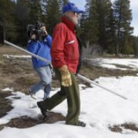
 Frank Gehrke (photo: Rich Pedroncelli, Associated Press)
Frank Gehrke poked his head out of the Sierra Nevada snowpack and promptly signaled that California was headed for a fourth year of drought.
“Clearly not good news,” the chief of snow surveys for California’s Department of Water Resources (DWR) told National Geographic last week. “With this paltry a snowpack, the runoff is going to be pretty sparse.”
The January survey of the source counted on to fill about 30% of California’s water needs wasn’t as miserable as last year, but was close. Snowpack in the northern and central mountains was 25% of normal and 27% in the south, for an average of 25%. It was 20% last year. But the department called it “dismally meager (pdf).”
That means more drought. “We haven’t historically seen a change in February, March and April—after a dry January—that would give sufficient conditions to erase the drought,” climatologist Mike Anderson of the California’s Department of Water Resources (DWR) told the Sacramento Bee.
Cities all across the state are reporting record or near-record paltry rainfall so far in 2015, but none more striking than in San Francisco. For the first time in the 165-year history of rain data collection, the city failed to get any measurable precipitation in January, typically the wettest month of the year. San Francisco usually averages 4.5 inches.
Bill Patzert, a climatologist at Jet Propulsion Laboratory in Pasadena, told the San Bernardino Sun it would take a “February and March miracle to get us up to any reasonable snowpack.” But even that wouldn’t bail the state out because it continues to use more water from the ground and reservoirs than replacement levels.
Storms in December had given hope that California might be headed for wetter days. That didn’t happen, but the rainfall did provide a small measure of relief by adding some depth to reservoirs that have declined to dangerously low levels.
Lake Oroville holds 41% of its capacity and is at 62% of its historic average. Shasta Lake is 44% and 65%, respectively, and San Luis Reservoir is 53% and 68%.
Gehrke’s picture was all over the news last week, conducting, with others, the monthly manual survey of snowpack in the most important month of the year. But the dismal numbers reported were actually based on data gathered on the ground and in the air.
“You can determine snow depth very, very accurately” from the air, Gehrke told the San Jose Mercury News. More than 100 electronic “snow pillows” scattered through the mountains weigh the accumulation that presses down on their sensors and relay the information to National Oceanic and Atmospheric Administration (NOAA) satellites.
Data is also gathered on a limited basis by a Beechcraft King Air 90 twin-engine turboprop equipped with laser-emitting sensors that can measure snow depth. The new science and technology have augmented the teams of ground surveyors, poking their hollow poles into sparse patches of snow, to confirm what just about any sentient being in California already knows.
This end of the drought is not in sight.
–Ken Broder
To Learn More:
Sierra Snowpack Dismal for January; Fourth Year of Drought Looks Likely (by Matt Weiser, Sacramento Bee)
California's “Dismally Meager” Snowpack Signals More Drought (by Warren Cornwall, National Geographic)
California Snowpack Gains Erased by Meager January Rainfall (by Jim Steinberg, San Bernardino Sun)
California Drought: Sierra Snowpack Measuring Is a Lot More Complex Than It Looks (by Kim Smuga-Otto and James Urton, San Jose Mercury News)
Miserable Sierra Snowpack Ties a Record Low Set Way Back in 2012 (by Ken Broder, AllGov California)
Scant Precipitation, Warm Temperatures Produce Weak Snowpack (California Department of Water Resources) (pdf)
- Top Stories
- Controversies
- Where is the Money Going?
- California and the Nation
- Appointments and Resignations
- Unusual News
- Latest News
- California Forbids U.S. Immigration Agents from Pretending to be Police
- California Lawmakers Urged to Strip “Self-Dealing” Tax Board of Its Duties
- Big Oil’s Grip on California
- Santa Cruz Police See Homeland Security Betrayal in Use of Gang Roundup as Cover for Immigration Raid
- Oil Companies Face Deadline to Stop Polluting California Groundwater


